India Size and Location - Test Papers
CBSE TEST PAPER-01
Class –IX Social Science (India-Size and Location)
General Instruction:
- All Questions are Compulsory.
- Question No. 1 to 4 carry one mark each. Question No. 5 and 10 carry three marks each. Question No. 11 and 12 carry five marks each.
- Write down the easternmost longitude of India?
- Write down the western most longitude of India?
- Write down the northern most latitude of India?
- Write down the southernmost latitude of India?
- Name the southernmost point of India? Is it visible today?
- Which is the most important latitude of the country? Give reason.
- Which is most important Longitude of the country? Give reason.
- Why is the difference between the duration of day and night hardly felt at Kanyakumari but not so in Kashmir?
- Why countries of the world selected their own Standard Meridians?
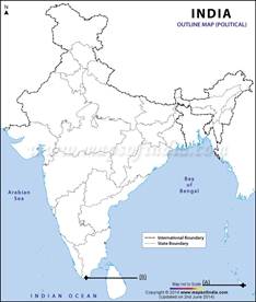
- Two features A and B are marked in the given political map of India. Identify these features with the help of the following information and write their correct names on the lines marked on the map.On the same political map locate and label the following
- Southernmost Point of India
- Southernmost tip of Indian mainland
- Easternmost Meridian
- The sun rises two hours earlier in eastern parts of Arunachal Pradesh as compared to Jaisalmer in the west but the watches show the same time. How does it happen?
- The central location of India at the head of Indian Ocean is considered of great significance. Why?
CBSE TEST PAPER-01
Class –IX Social Science (India-Size and Location)
[ANSWERS]
- 97025’ E
- 6807’ E
- 3706’ N
- 804’ N
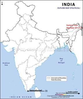
- The Southernmost point of India is Indira Point.
- The Indira point is situated in the Great Nicobar group of Island in Andaman Nicobar island groups.
- which is located in the eastern Indian Ocean at 6°45'10″N and 93°49'36″E. This is not on the Indian mainland but within the Union Territory of Andaman and Nicobar Islands.
- It is not visible today because it was submerged under the sea in the 2004 Tsunami.
- The tropic of cancer is the most important latitude of the country.
- It is situated at 23 ½ N.
- The tropic of cancer divides the country into two equal parts. in which the upper half is having a tropical climate while the lower half is having a sub tropical climate.
- 82030’ E, longitude is the most important longitude of our country.
- To avoid confusion and chaos in all activities to be caused by having a different local time for different places.
- The central Meridian 82030’ E is taken as the Indian Standard Time.
- It is accepted all over the country for uniformity of time.
- The day and night are nearly of the same duration at the equator.
- As Kanyakumari is quite near the equator at 8°4'N the day-night difference is hardly one hour there, and therefore, the duration of day and night is hardly felt at Kanyakumari.
- On the other hand, as we move away from the equator to the poles the variations in duration of day and night become greater.
- Kashmir is over 30° away from the equator and so the difference in duration of day and night is more there and we feel that difference.
- Every country has a Standard Time to avoid confusion of time.
- It is the time of its Central or Standard Meridian.
- Each Meridian has its own local time which is the sun time or local time of that particular place.
- To avoid confusion and chaos in all activities to be caused by having a different local time for different places the central meridian is selected as Standard Time.
- Some Countries whose size is very large they have their different time zones.
- India has a longitudinal extent of 300. Due to this, there is a time lag of two hours between the sunrise on the easternmost and the westernmost horizons of India.
- Due to the rotation, the earth takes 4 minutes to rotate through 10 of longitude. The difference in time is one hour for 150 of longitude.
- Therefore, for a longitudinal extent of 300 of India, there is a time lag of two hours. When it is 6 a.m. in Arunachal Pradesh, it is still 4 a.m. in Gujarat and Jaisalmer.
- But the watches in all parts of India are run according to standard time measured from 82 ½0 longitude.
- So the watches in Arunachal Pradesh and Jaisalmer show the same time despite the different sunrise.
- The central location of India at the head of the Indian Ocean is considered of great significance because:
- It has given India a strategic advantage due to the Trance Indian ocean routes which connect the countries of Europe in the west and the countries of East Asia.
- This helps India to establish close contact with West Asia, Africa, and Europe from the Western Coast and with the Southeast and East Asia from the Eastern coast.
- The vast coastline and the natural harbors have benefited India in carrying out trade and commerce with its neighbouring and distant countries.
- It has given India a distinct climate than the rest of the Asian Continent.
- In fact, India only has the longest coastline in the Indian Ocean in the world.
